

Navigating the world’s oceans is no easy task. With thousands of ships at sea at any given time, the accuracy of the information they rely on for sailing through the oceans is critical. Seafarers must make decisions in real-time, often depending on the quality of data available in their electronic chart display systems. One key element that helps assess the reliability of this data is CATZOC—Category Zone of Confidence.
In this blog, we’ll explore what CATZOC means, how it works, and why it plays a central role in safe navigation today.

What is CATZOC?
CATZOC, short for Category Zone of Confidence, is a system used to describe the accuracy of hydrographic data shown on nautical charts and electronic chart display systems (ECDIS). It’s an assessment tool that helps mariners understand the reliability of depth measurements, position accuracy, and seafloor coverage in a given area.
When navigating unfamiliar or poorly surveyed waters, CATZOC becomes a critical reference. It highlights how much trust a navigator can place in the charted depth and position data.
What Does CATZOC Do?
CATZOC doesn’t change your route—it informs how you read your electronic nautical charts (ENCs). It identifies areas where the data is highly accurate and areas where it might be outdated or incomplete. In doing so, it supports smarter decisions in voyage planning and real-time navigation.
Each zone has a rating from A1 (the most accurate) to U (unassessed), allowing seafarers to judge risks and adapt their under keel clearance and speed accordingly. A CATZOC rating also alerts the crew to the possible presence of underwater obstructions that may not be well documented.
Why Is CATZOC Important?
Imagine navigating near the Pacific Ocean archipelagos using ENC data that dates back over a hundred years. While the depth on the chart might show 20 meters, if the CATZOC is rated “D” or “U,” it means the position and depth accuracy could be significantly off. This could place the ship hull in danger, especially in shallow waters.
CATZOC ensures the crew is aware of these limits and takes corrective measures. For shipowners and teams, understanding CATZOC supports better passage planning and risk mitigation.
Historical Methods: Measuring the Ocean Before SONAR
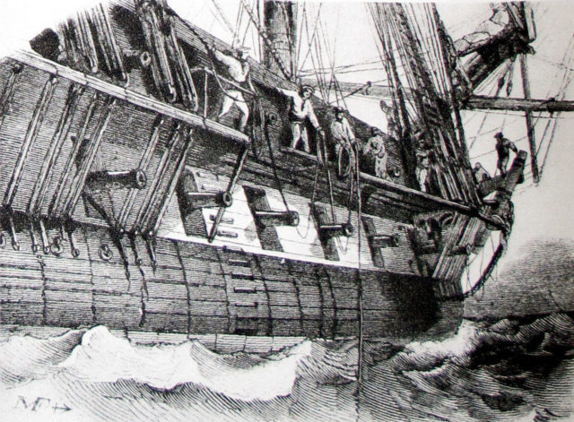
Image Source: The Vintage News
Before modern sonar, mariners measured ocean depths using lead lines, acoustic signals, and wire dragging methods. Ships would tow a weighted wire to detect any underwater features the wire encountered. These techniques provided only rough estimates of the seabed and lacked accuracy.
Today, we know these methods were prone to error, especially when navigating near complex seafloor topographies or coastlines.
SONAR and the Evolution to Multi-Beam Surveys
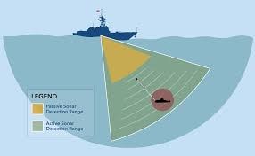
Image Source: US Navy
The introduction of SONAR (Sound Navigation and Ranging) revolutionized ocean depth measurement. Using sound propagation, vessels could measure distances by calculating how long it took for an echo to return after bouncing off the seabed.
Modern multi-beam sonar systems further advanced this method, capturing wide swaths of seafloor in a single pass. This helps with detailed and more accurate hydrographic data that improves the quality of nautical charts.
Understanding the Chart: Reading CATZOC on Nautical Charts
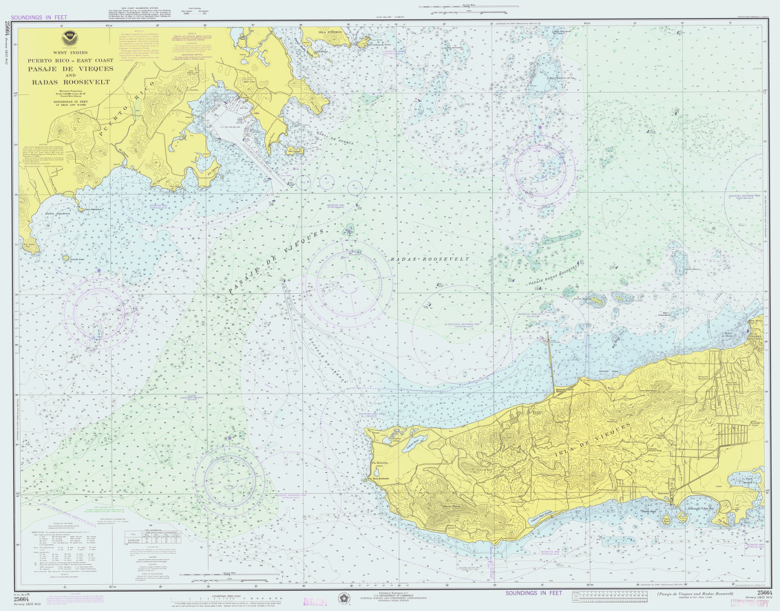
Image Source: Wikipedia
CATZOC values are displayed on ENCs as triangular or lozenge symbols with stars. These stars—ranging from six stars (A1) to two stars (D)—indicate how confident you can be in the ENC data.
On ECDIS, CATZOC values are overlaid on ENC data using star symbols. The more stars, the more accurate the data. Mariners can use these visual cues alongside the chart’s source diagram to determine how recent the survey is and how trustworthy the depths and positions are.
The Six Levels of ZOC: What They Mean
Each zone of confidence represents a specific range of accuracy in both position and depth. The table below simplifies this:
| ZOC | Position Accuracy | Depth Accuracy |
|---|---|---|
| A1 | ±5 meters | ±0.5m + 1% of depth |
| A2 | ±20 meters | ±1.0m + 2% of depth |
| B | ±50 meters | ±1.0m + 2% of depth |
| C | ±500 meters | ±2.0m + 5% of depth |
| D | > ±500 meters | > ±2.0m + 5% of depth |
| U | Not assessed | Unknown |
These values help in determining the margin of error and making more informed navigation choices.
CATZOC and Passage Planning
When building a passage plan, especially for vessels operating with tight under keel clearance, CATZOC becomes a critical factor. Planners must not just consider the draught and squat of the vessel but also the confidence level of depth data in each leg of the route.
For example, a CATZOC C zone with minimal seafloor coverage might require an additional margin of safety, such as increasing UKC by 25%. This compensates for possible measurement errors or undetected underwater obstructions.
Why CATZOC Matters to Seafarers
For deck officers and navigators, CATZOC is more than just a symbol on a screen—it’s a layer of insight that affects every navigation decision. A good navigator will consider:
-
How old the data is
-
What method was used to collect it
-
The quality rating (CATZOC level)
-
Additional information from sailing directions and bridge publications
With accurate CATZOC interpretation, mariners reduce risks related to grounding, collision with underwater features, or inefficient routes.
Risks and the Potential for Error in Depth Accuracy
Low CATZOC areas present real risks. Mariners relying solely on electronic information systems without considering these ratings may find themselves navigating in shallow waters with inaccurate depth data.
Underwater obstructions might not be charted, or their positions could be off by hundreds of meters. This makes source diagrams and proper passage planning essential.
The Role of Source Diagrams
Before CATZOC, source diagrams on paper charts provided survey information—date, method, and coverage. Today’s ENCs still include this data in the metadata and M_QUAL layer. When navigating near poorly charted regions, referencing both the category zone and source diagram is a best practice.
Well-informed crews use both tools to validate passage plans, especially when other factors such as charterparty clauses, weather routing, or voyage timelines come into play.
Conclusion: Trust the Data, But Understand It
In the digital age, it’s easy to take charts for granted. But understanding what lies behind the lines—how the data was collected, when it was surveyed, and how reliable it is—is what makes navigation safe.
At Nautilus, we empower our crews with more than just equipment—we ensure they understand how to use every layer of information available to them, including CATZOC.
Whether you’re sailing through the Pacific Ocean or navigating narrow coastal channels, understanding zone of confidence ratings, under keel clearance needs, and hydrographic survey quality can be the difference between smooth sailing and a serious incident.
FAQs
1. What does CATZOC stand for?
Category Zone of Confidence.
2. How does CATZOC affect my route?
It helps determine the reliability of the ENC data, which in turn affects route selection and under keel clearance calculations.
3. Do I need to revert to paper charts in low CATZOC areas?
No. Both paper and ENCs are based on the same data. But you must supplement with source diagrams, sailing directions, and risk assessments.
4. What are CATZOC values used for?
They guide decisions in passage planning, help avoid navigational hazards, and support safe navigation in uncertain areas.
5. How often are CATZOC ratings updated?
It depends on the survey frequency. Areas with high traffic or strategic importance are updated more frequently than remote zones.